This is a Puna tour which takes you a long way off-the-beaten-track, far from any tour buses and groups. This actually delivers the middle of nowhere experience, some spectacular landscapes and visits to isolated people.
Day 1 – Quebrada del Toro | San Antonio de los Cobres | Tolar Grande
Distance: 100 km on paved roads / 250 km on dirt tracks and gravel roads.
Altitude: Highest point 4.500 m – Tolar Grande 3.500 m – Estimated driving time: 6 hours.
Your Puna tour starts today when we pick you up from your hotel in Salta and drive you through the stunning Toro’s Gorge (Toro means Bull in English) providing some great photo opportunities. The road climbs up steeply to the high desert plateau (the Puna), via the lush Lerma Valley. In less than 100km of distance this road winds and switchbacks up from 1200 meters near to Salta to over 4000 meters at the Abra Blanca Pass.
The region covered on your Puna tour was well traveled by the Inca empire with its capital in Cusco, Peru and eventually a 500 kilometer network of Inca trails were built to connect the Inca Empire from its extreme North in Quito, Ecuador, through Peru to Mendoza in Argentina. San Antonio de los Cobres is the actual Capital of the Puna today, a dusty village mostly famous for the Tren a las Nubes.
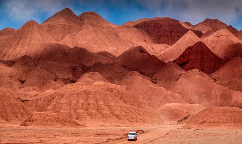
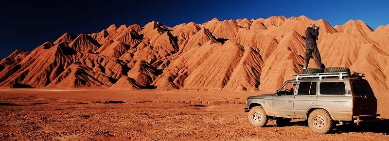
The Abra Chorrillos pass will be our highest point today and here we will learn about the Apacheta and its cultural importance for the Andean civilizations. After the crossing of the geologically dying Salt lake of Pocitos, an exciting 3-hour drive in very wild and unspoilt landscapes begins. The Labyrinth Desert is a 10 million–year old fossil dune desert formed from clay and gypsum crystals.
We will drive across this natural wonder, an absolute must for photographic safari enthusiasts. Tolar Grande lies at the border of a giant low-lying salt flat, the Salar de Arizaro. This is one of the biggest salt flats in the world and from the tiny old railway village dating back to the 1940s there is a unique view over the western ridge of the mountain range and volcanoes rising to more than 6000 meters above sea level.
Day 2 – Explore Tolar Grande | Salar de Río Grande | Puna Tour
Distance: 130 km on paved roads. 180 km on dirt tracks and salt roads.
Altitude: Highest point 5.200 m – Tolar Grande 3.500 m – Estimated driving time: 7 hours.
On your Puna tour today we will go exploring literally in the middle of nowhere. Mina Casualidad was a mining town located in one of the most remote places on Earth. This outpost is located very near to the border with Chile and is surrounded by some of the highest volcanoes on the planet. Some 3000 people used to live here with the miners working at around 5200 meters so we can only imagine how tough that life was! The mine was shut down by the army during the 1970’s and today Mina Casualidad is a true Ghost Town.
Caipe was the old railway station where the mineral from the mine was loaded and then transported to Salta. From the now abandoned station we get a great panoramic view of the huge Salar de Arizaro. In the afternoon on our way back to Tolar Grande, hopefully with the perfect light from sunset, the views of the Puna will be outstanding.
Note: The road access to some locations may be closed in winter in case of heavy snow.
There are other options for visits today also, and this will be decided by your guide depending on local conditions, plus of course your personal choices where we can accommodate them.
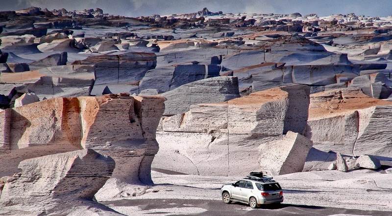
For example the morning can be dedicated to the exploration of the areas surrounding Tolar Grande. The Ojos del Mar are blue holes in the middle of the white salt lake where in 2009 researchers discovered a huge colony of living stromatolites.
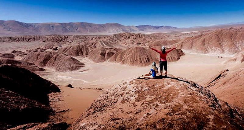
The Tolar Grande area offers the chance to make some interesting short hikes, the best one in our opinion is to a hidden sand dune in the middle of the desert. From the top of this dune the hiker will be rewarded with a 360° panoramic view from the sacred Macon mountain to the Llullaillaco Volcano where the Inca children which can be viewed in the MAAM museum in Salta were found. It is also a perfect place for meditation taking advantage of the silence and majesty of nature.
Day 3 – Oasis Antofallita and Antofalla | Vega Colorada | Calalaste | El Peñón
Distance: 340 km on dirt tracks and salt roads.
Altitude: Highest point 4.500 m – El Peñón 3.400 m – Estimated driving time: 7 hours.
Antofalla is a spectacular example of a how vegetation can flourish in a Puna Oasis and is set in the middle of a high altitude desert thanks to the presence of a natural pure-water spring. In this seemingly barren place a number of Poplar, Molle and Willow trees grow with various crops tended by this very isolated community.
Antofalla, together with Antofagasta and Santa Rosa, were important waypoints for the many llama caravans that used to connect this part of the Andes with the Atacama oasis and indeed Antofalla is still inhabited by a tiny community of 60 people. We will stop for lunch here before traveling across the reflective surface of the salt lake.
We will now be traveling above 4200 meters affording impressive views of the Antofalla Volcano (6400 mts), the green and gold fields of Vega Colorada, home to herds of llamas, suris (the Andean ostrich), wild donkeys and vicuñas. The valley of Calalaste, just a few kilometers away from Vega Colorada is the best spot to find wild camelids. Antofagasta de la Sierra was once the largest oasis on the route connecting this side of the Andes with the oasis of San Pedro de Atacama in Chile. Today it is a village of around 2000 people who stoutly cling to their ancient traditions and culture.
Day 4 – El Peñón | Campo de Piedra Pómez Laguna Grande | El Peñón
Distance: 130 or 200 km on dirt, gravel and salt tracks.(Depending on the season).
Altitude: Highest point 4200 m – El Peñón 3400 m – Estimated driving time: 3 to 6 hours.
Program from October to April (austral spring / summer season): Morning: Visit to the Natural Reserve Campo de Piedra Pómez, a strange and stunning landscape carved into the rock that gives the area its name. Piedra Pomez means Pumice Stone.
Pumice is produced from volcanic explosions which are often so powerful that the visual effect would have been similar to the mushroom cloud produced by a nuclear detonation. The cloud then spreads ashes and debris over a wide area giving birth to unusual rock formations with many holes formed by the escape of gases during cooling.
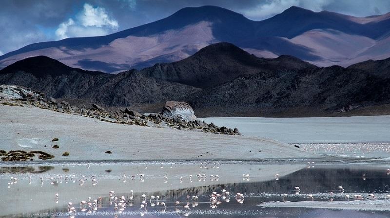
Afternoon: Visit to Laguna Grande RAMSAR site, a place of unique natural beauty. This salt lake sits at an altitude of 4150 meters above sea level. During winter the water freezes solid, but when spring arrives the area welcomes the largest colony of Puna flamingo, also called Small Parina (Phoenicpterus Jamesi). More than 19,000 birds visit the area which is around 25% of the known total population and your Puna tour offers a great chance to see then close up. Laguna Grande is a summer stop for the Andean Flamingo (Phoenicpterus andinus) and also a common nesting site of the Southern Flamingo (Phoenicopterus chilensis).
The program of visits from May to September (or in the case of adverse weather conditions) may vary a little so please ask us to explain any changes.
Day 5 – Hualfin | Santa María | Cafayate | Quebrada de las Conchas | Salta
Distance: 440 km on paved roads – 50 km on gravel roads
Altitude: Highest point 4100 m – Salta 1200 m – Estimated driving time: 7 hours.
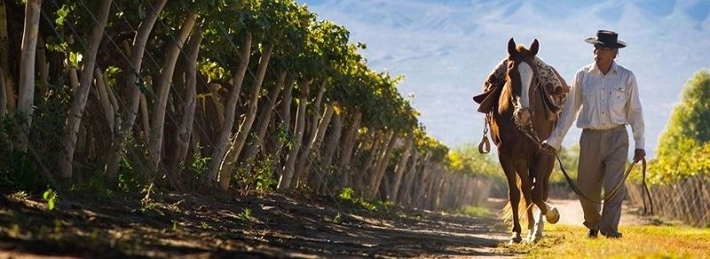
After a few days of the “middle-of-nowhere” travel the North West of Argentina still has plenty of delights to show us, and with a little more comfort this time. The paved road from El Peñón which joins the fabled Argentine Route 40 is a 150km-long yellow expanse of Paja Brava (hardy high-altitude grass), white lagoons and a deserted narrow canyons with scattered green vegetation. We will have a quick stop in Cafayate, the center of wine making in this area of the country.
If you wish to spend a couple of extra days in Cafayate at the end of your Puna tour experience, enjoying wine tours and tasting, just let us know – it is easily set up.
In the afternoon with the best light of the day we will drive through the Quebrada de las Conchas Gorge, 55 km of scenic rock formations. Finally we head back to Salta with the lush, green valleys welcoming us back after our unique adventure. Optional visit (time permitting): Quilmes Ruins, probably the most interesting Pre Inca Ruins, with a dramatic ancient story.